
How do we pick where we climb? Sometimes it’s just the cheapest trip we can put together. Whatever countries we’re considering there is always a google question to my phone, “What is the highest mountain in _____?”. Followed by, “Best month to climb Mt _____?”.
We only had a week so we would find a country not too badly affected by all the storms and travel toward the end of the rainy season. Belize, Panama and Cuba made the list. The Cuba climb had a fascinating historic element that intrigued us but we were hopeful to find a ‘deal’ at one of the countries we haven’t traveled to yet. Alas, at 3 times the price and more lost days due to travel, we quickly jumped on Cuba.
The Sierra Maestra mountain range is along the most remote south eastern shores of Cuba. To put this into perspective for all you beach travelers to Cuba, it’s 800 kilometers away from Varadero on roads that would not qualify as highways; like driving from Toronto to Quebec City on country roads. Given we were travelling in the low season, it made the most sense to book a cheap all inclusive and abandon the comforts of a bed and free alcohol for 3 days of sleeping in the forest and dehydration. With only one option for all inclusive resorts near the mountain range, the decision was easy.

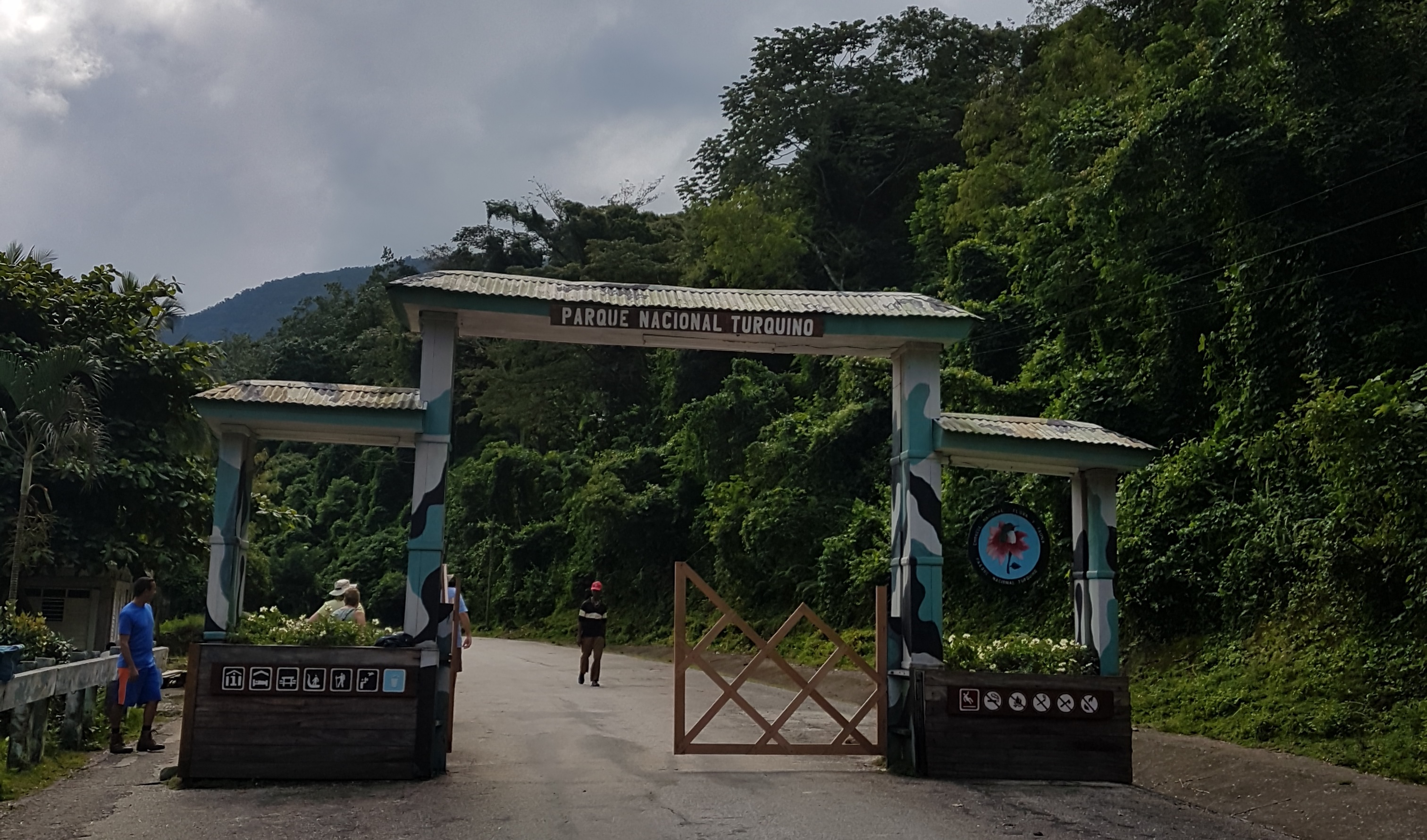
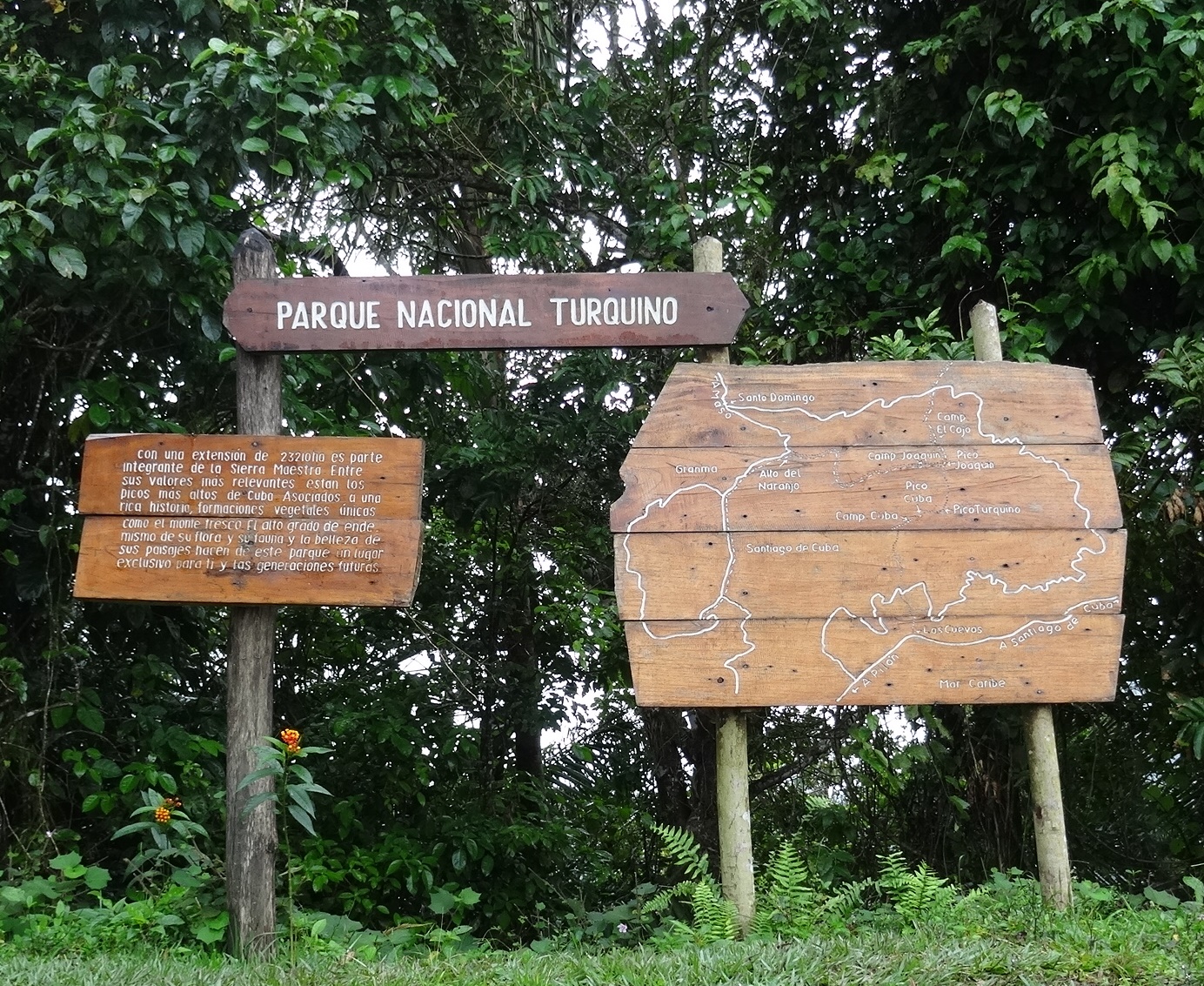
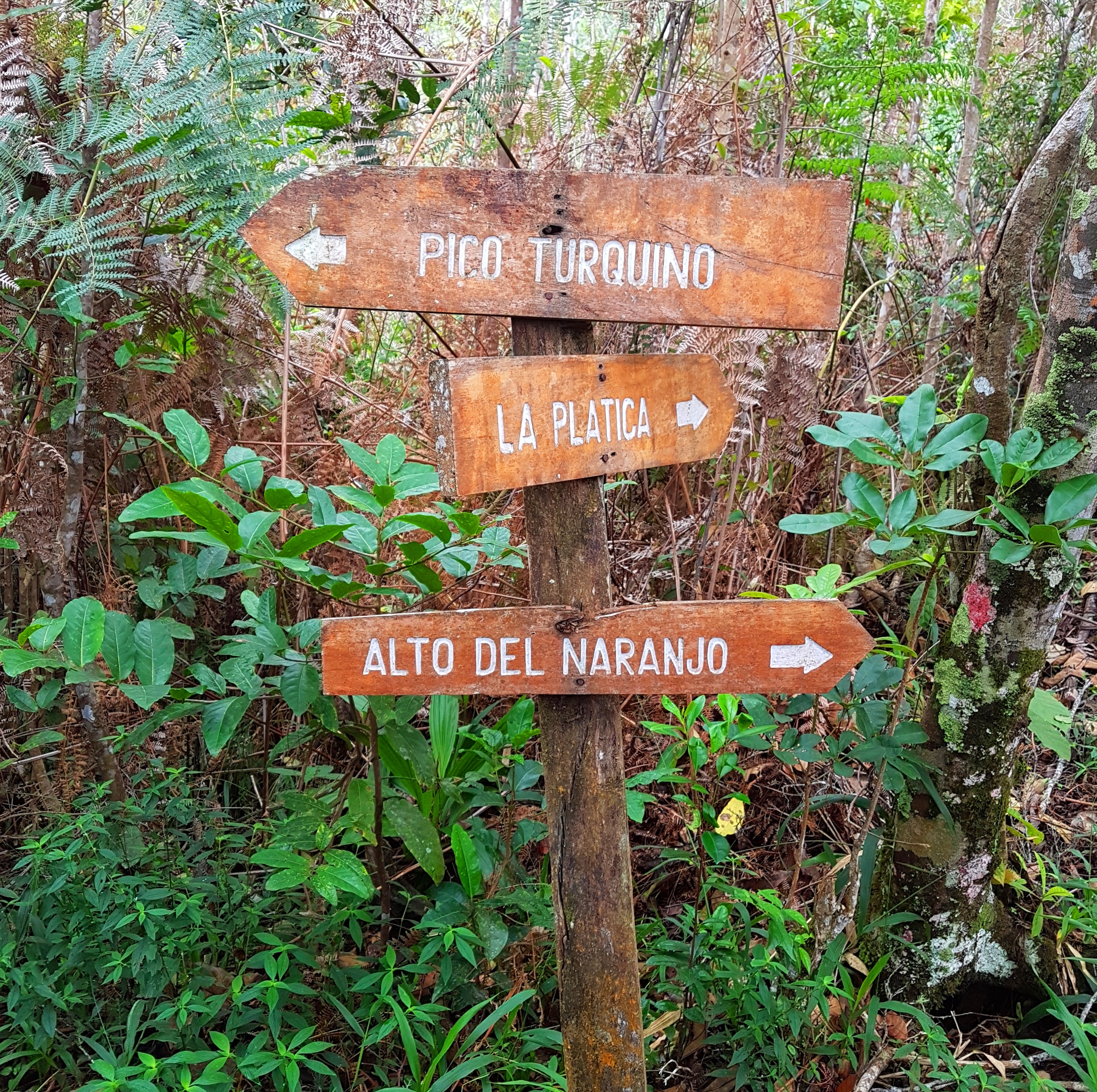
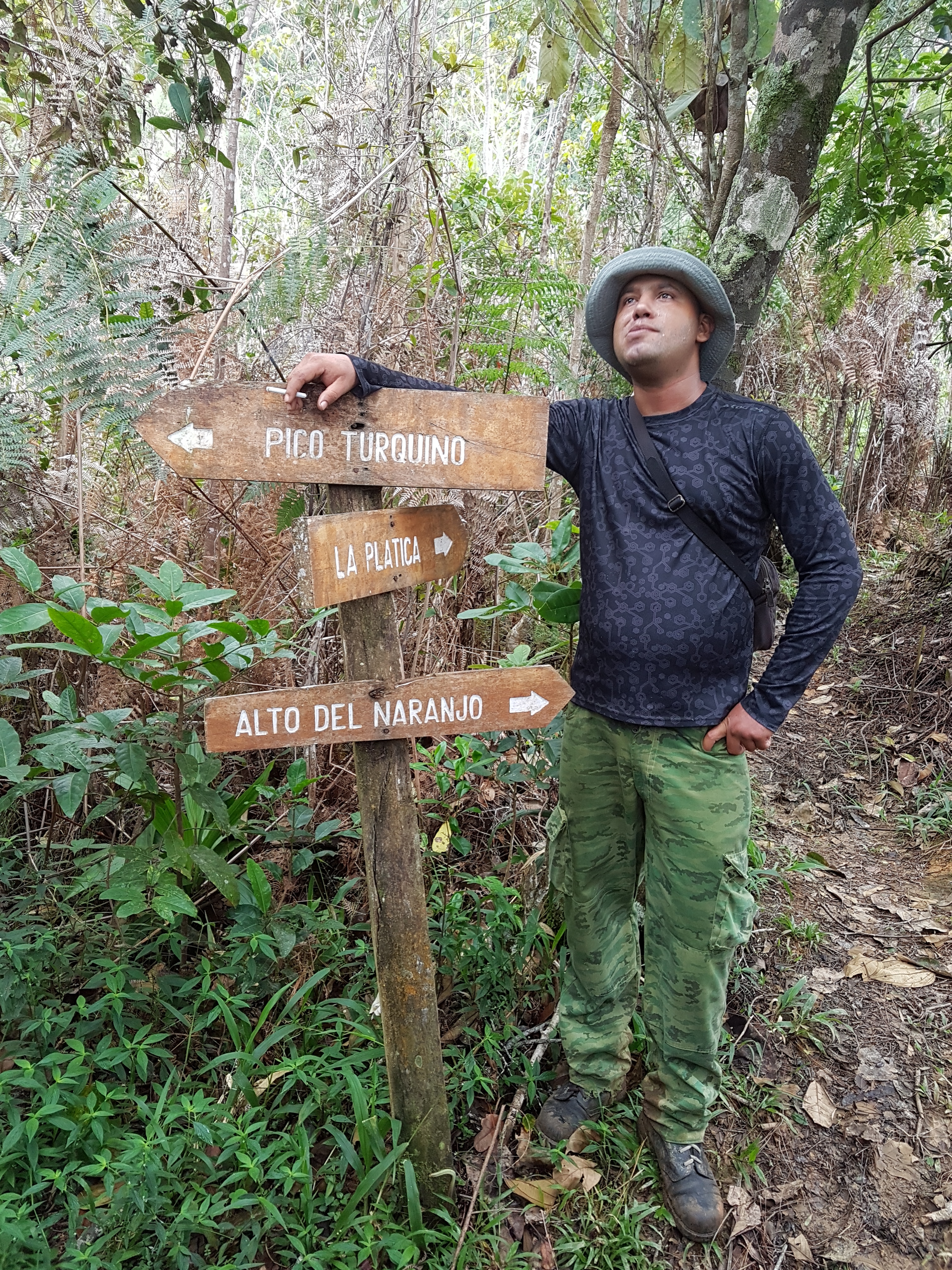
Figuring out the climb portion wasn’t so easy. Confirming a guide from Canada wasn’t happening so we absorbed what we could from the few climbers who blogged online about this trek and decided we would just get ourselves to the Gates of Turquino National Park. We arranged a driver through the resort to take us from Marea near Pilon to a very small mountain village on the other side of the range; Santo Domingo. This town doesn’t even show up when you do a google search unless you add Sierra Maestra, we suspect it only exists due to the small amount of traffic to the park gate. We so much appreciate adventurers who share their experiences online! How did we all travel pre-internet?
Our driver was to arrive at 6 am, he arrived at 6:22 am. Cuba time! The drive was to take 2 hours, it took 3 hours. Cuba roads! The park gates are open only until 10 am, we arrived at 9:52 am. Whew! Just as the final group was about to start the hike to Fidel’s rebel hideaway we were rushing to book a night at the local villa, off load our big packs and pay the $90 CUC entrance fee. As we paid our park fees the manager announced there were no spots left for the climb the next day and they would likely be closing the summit climb indefinitely due to bad conditions on the trails and inability to maintain them properly. WHAT?! The park office was closing and we were being summoned to load up for the ride to the trailhead. That was a bit of a bomb on our plans!
 We are pretty easy going but than we’ve been pretty blessed with our adventure travels; always exceeding our expectations. We treat hiccups like adventures that lead to better outcomes. This wasn’t a hiccup, our whole trip revolved around the summit climb. We could actually be enjoying mojitos on a beach in a country we hadn’t experienced yet.
Into the truck we jump pondering our dilemma as our eyes catch each other and we reluctantly say, “It always works out”.
Then it started to rain!
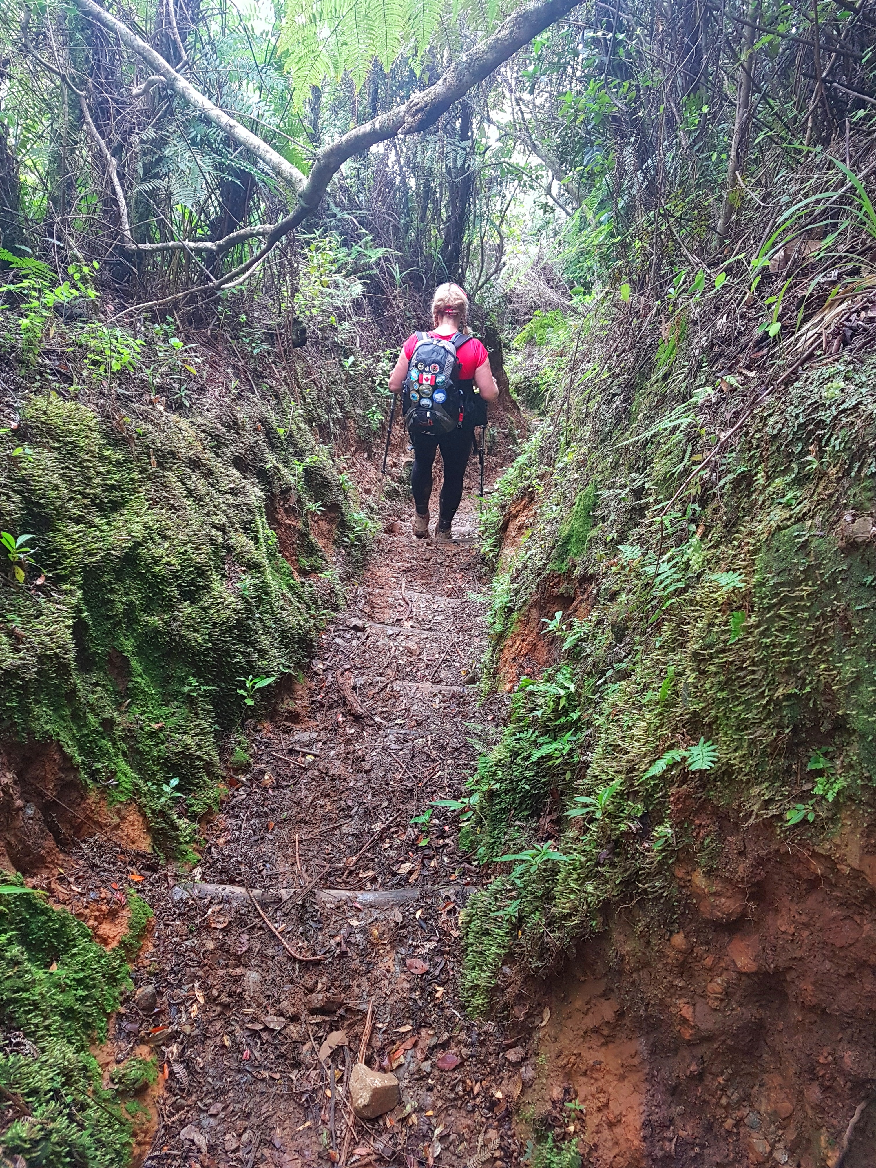
Shockingly, we have never had a single day of rain on any of our major treks, EVER. But we knew we were going to a rain forest at the end of rainy season so the potential was real. Quite frankly, it was about time and the absolute best conditions for some rain with temps around 27 Celsius. Rain forests however, do not produce drizzle, sprinkles, mist or spit. It would be full on pouring rain so hard you needed a brim to keep the drops from your eyes; I had a buff. “You bringing your gaiters Karen”, Jeff asked a few days ago. “Too heavy, they’re for snow and gravel anyway”, I responded. Famous last words! Rain = Mud. Several months of rainy season equals over a foot of mud and vegetation so green, lush and bushy it threatened to overtake the narrow trails. Live and learn. “Let’s get dirty Jeffy!”
 At the trailhead we were put with a group of Germans who are generally known to be good hikers (with a beer goal at the end) and speak English well. Given there were 10 of them and 2 of us, they chose their native tongue. Our guide didn’t speak English but Anatelli, the guide from the German group, thoughtfully translated while we were sludging through the mud. In between we entertained ourselves by keeping an eye on one of the Germans who showed up with shiny, black dress shoes and dress pants. We suspect he didn’t fully read his trip itinerary, although he did keep up stoicly.
Taking the same route as Fidel, Che and his rebels was fascinating. To think University students created activist groups that eventually merged to overtake dictator Batista as leader of Cuba. How could a small rebel force of 300 overtake a legit army of 20,000? Let’s just say Fidel had some balls every step of the way leaving Cuba at one point to recruit an army in Mexico where he met Che who helped him buy a boat named Granma to secretly return to Cuba and hide in the mountains. We all know how the story ends; a Dictator is exchanged for a Communist.

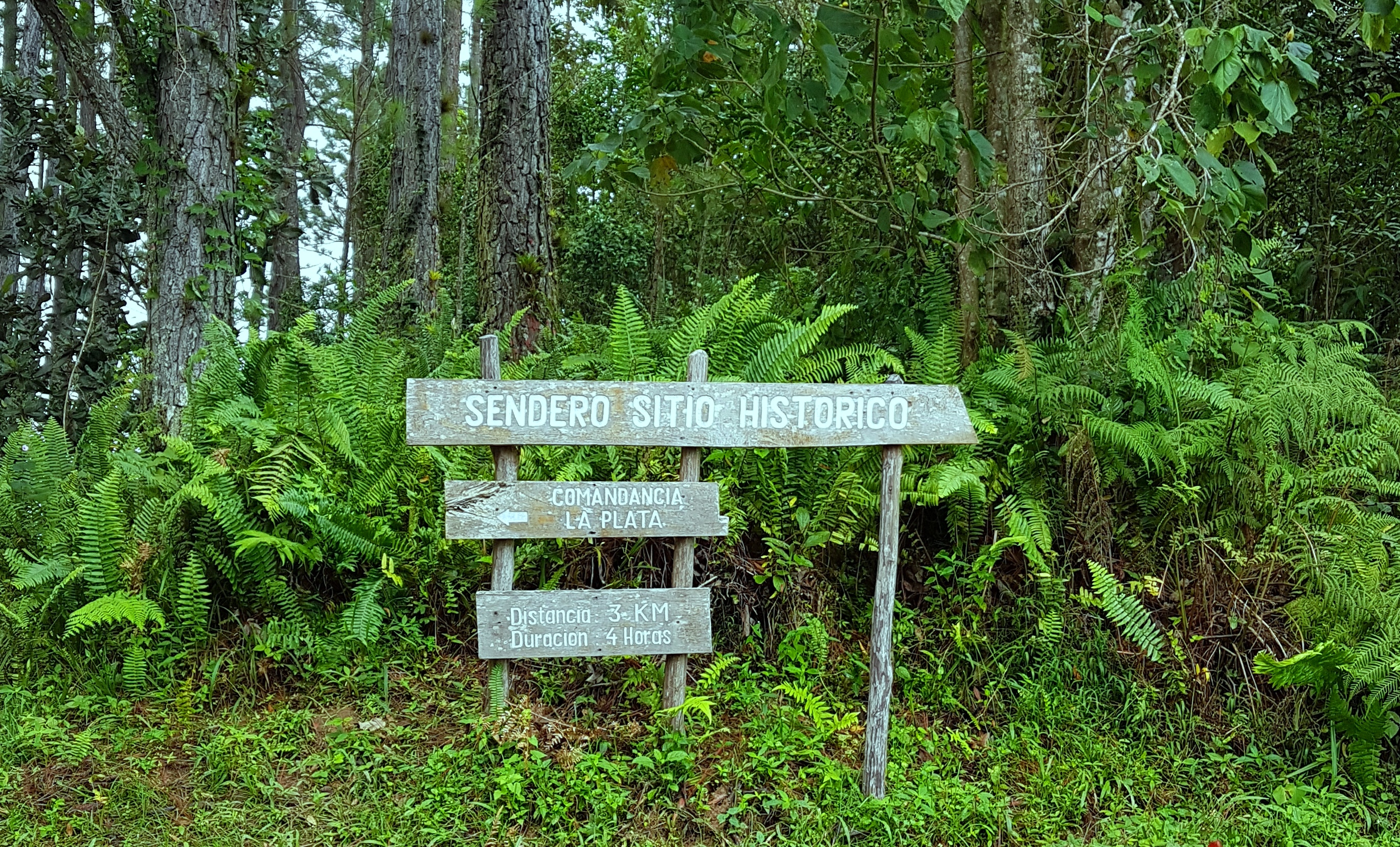
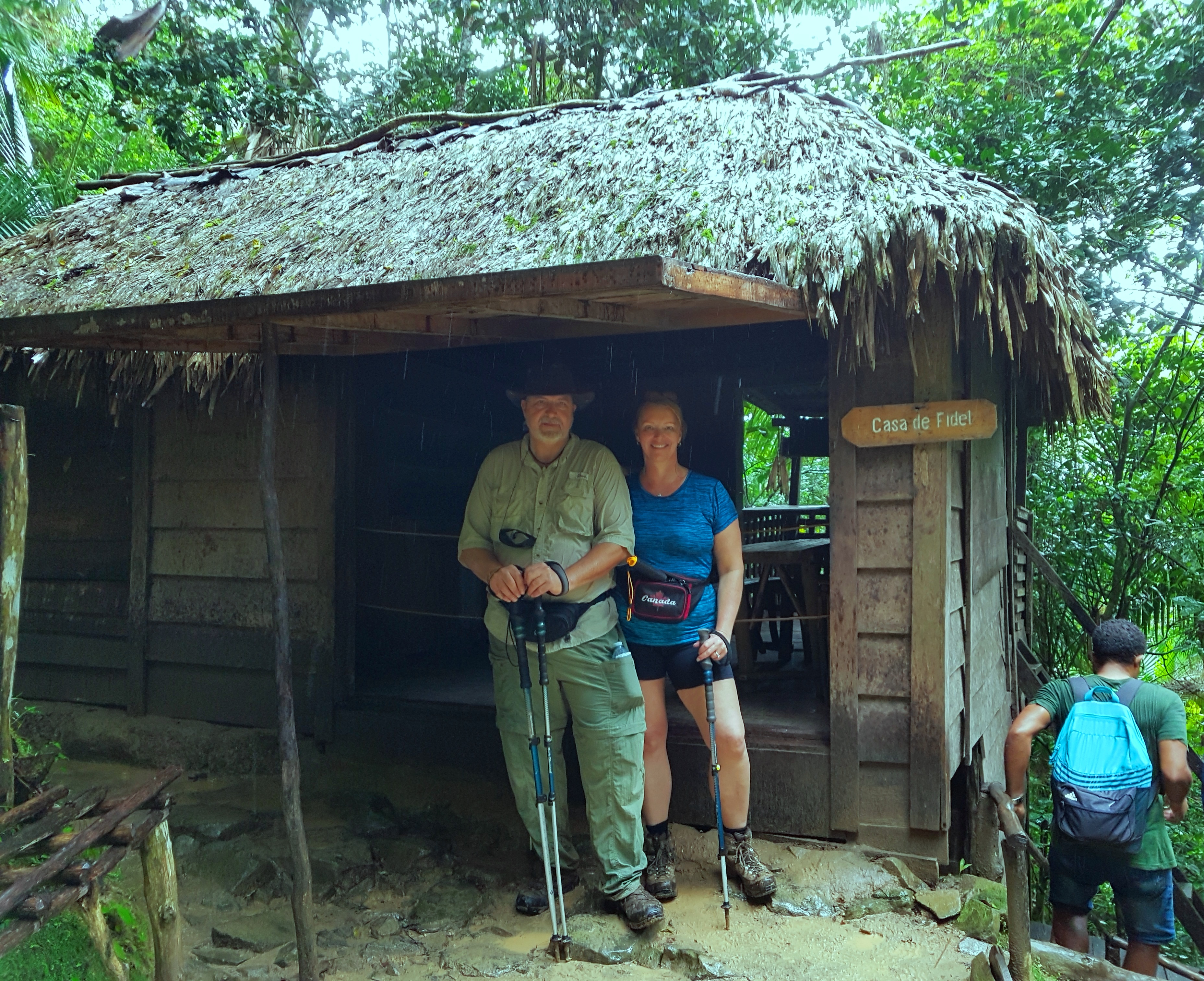
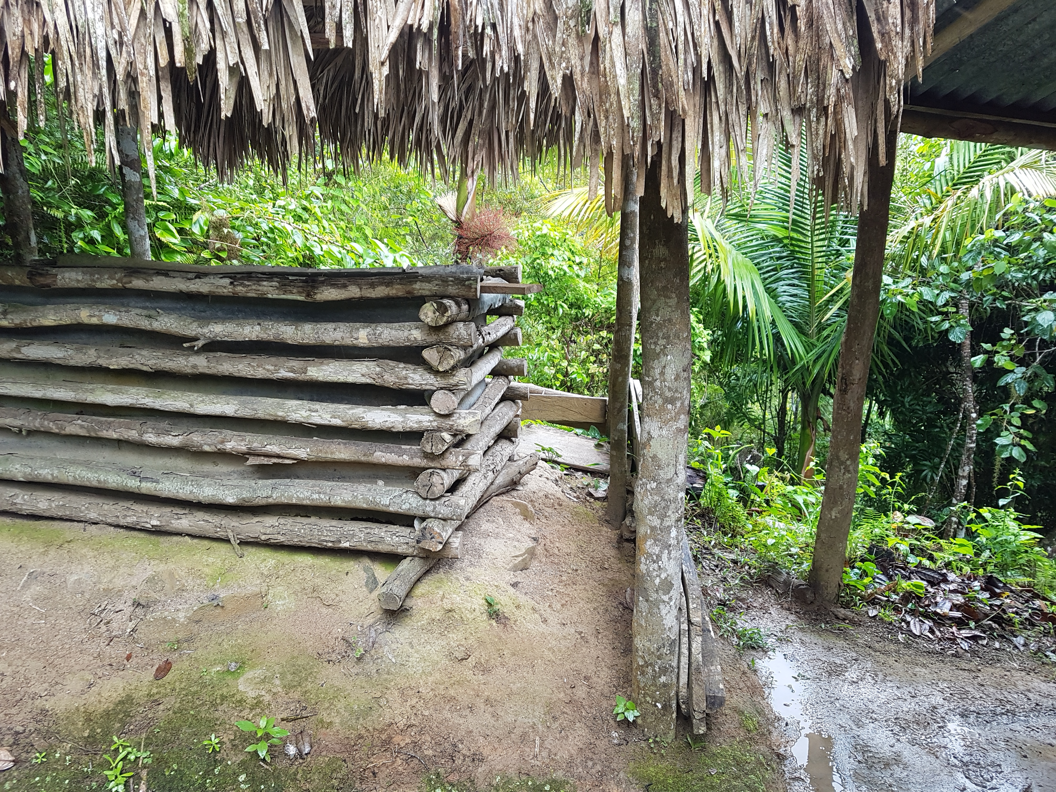
While the distance was only 3km each way (more on this mis-truth later) to the Comandancia de la Plata, it was a rugged trail on a mountain. As we arrived at the first pit stop we got our first real view of the layers in the mountain range and the rustic home of the family who helped feed the rebel forces. It was quite a walk up before we hit the helicopter pad area then the command center. Fidel’s actual residence being the highest with multiple escape routes, a bath tub situated enviously on the side of the mountain, real bed and an actual 1950’s propane fridge. While taking pictures of Fidel’s hut a UK’er, Craig, started chatting us up about climbing Turquino and how he was looking for drinking buddies in the village tonight. The conversation came round to how we were told there was no room at the Camp on the mountain. He spoke fluent Spanish and offered to speak to the guides and negotiations for our trek began. “We will sleep outside on the ground”, we told him, just help us get approved to enter the park … and he was off. Anatelli was also helping to spearhead our bid for spots and would actually be the guide for the UK group to the summit.


What goes up must come down and the rain had made for an even a muddier mess on the 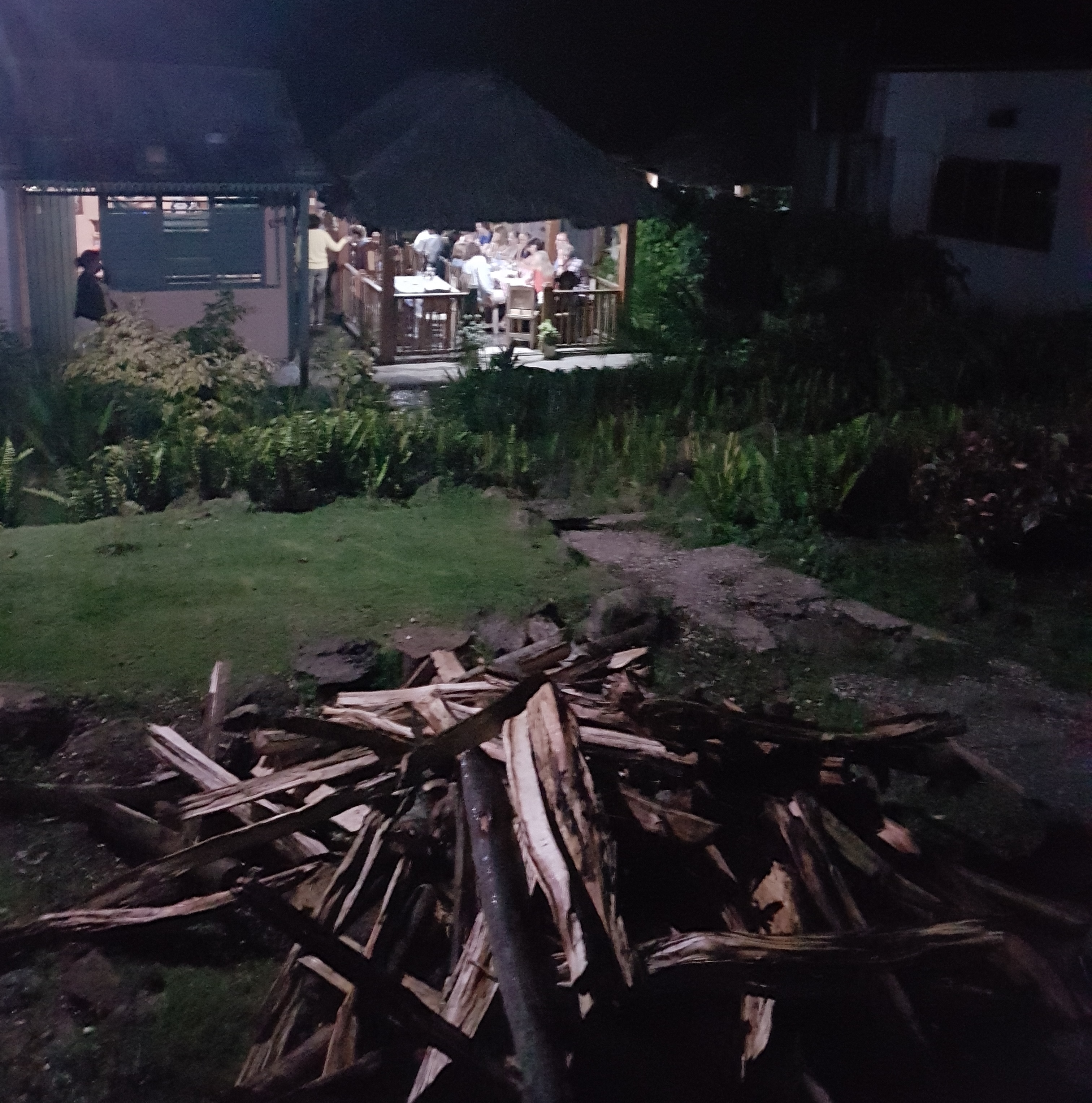 way down but we knew this was a great warm up for the next two days. We were anxious to confirm if we would be able to climb but it was not to be until the park opened at 8 am the following morning. At least we knew the wheels were in motion so we headed out with Craig to a house down the road that was roasting a pig for a $15 dinner that included 3 drinks. It was a makeshift backyard restaurant that filled with people for the evening and a couple of Craig’s group mates escaped the structure of their trip to join us for drinks and laughs. After dinner, we literally walked across a river to what appeared to be a makeshift
 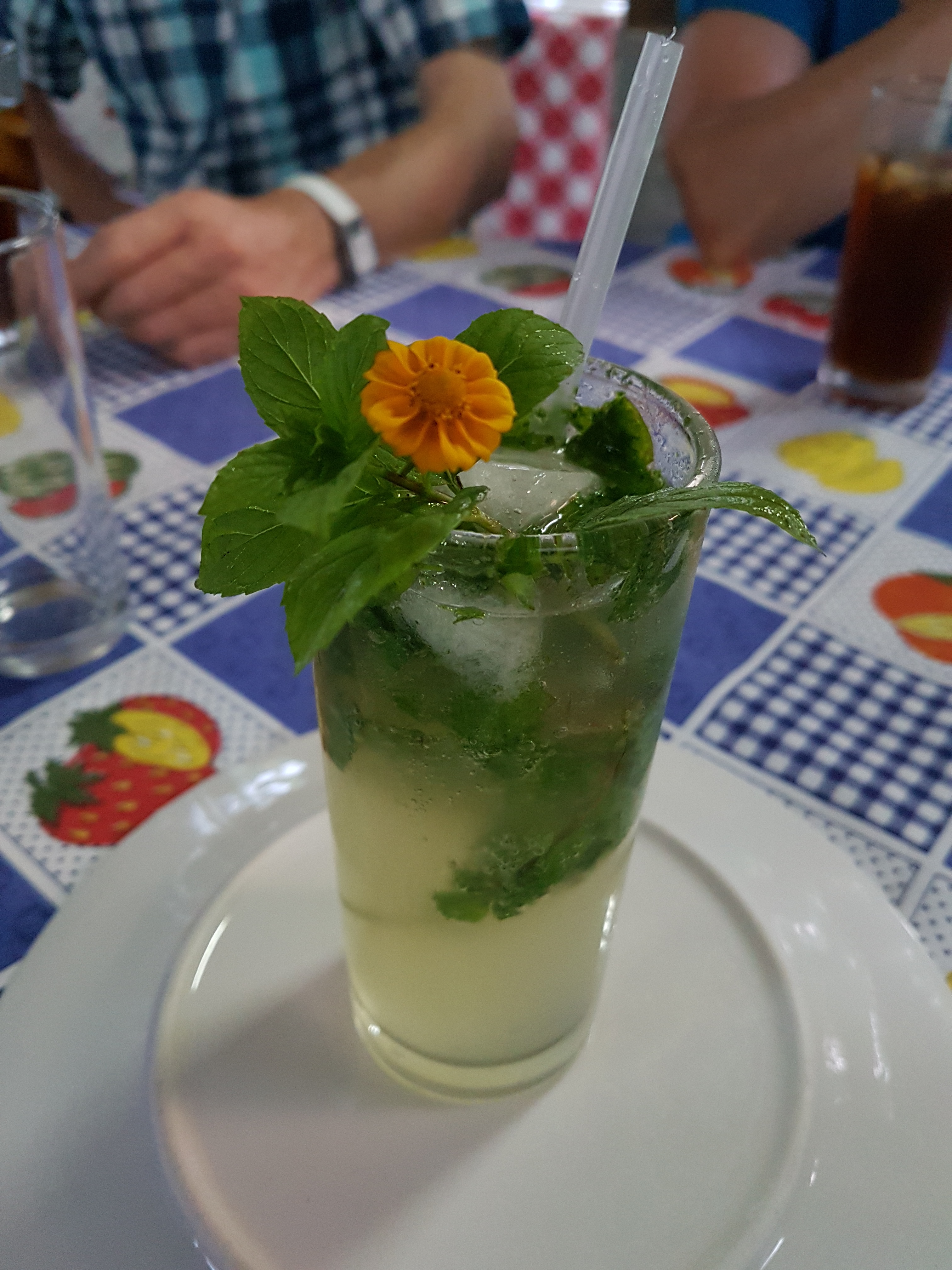 bar in another backyard for more drinks then back to our villa where some musicians were practicing and let us dance along. Thanks to the impressive entrepreneurship of locals, we were actually bar hopping on a mountain. Although our willingness to suck back cheap drinks didn’t show it, we were assuming we were climbing for 6 hours the next day. Another repacking job and our heads hit the pillow.
We were at the park office for 7:30 am ready and waiting for it to open. At 8:45 it was finally confirmed we could be add-ons to the UK team. It pays to make friends on the mountain and we’re thankful to Anatelli and Craig for the opportunity. We paid our $95 CUC each and hopped in the trucks for the trailhead.
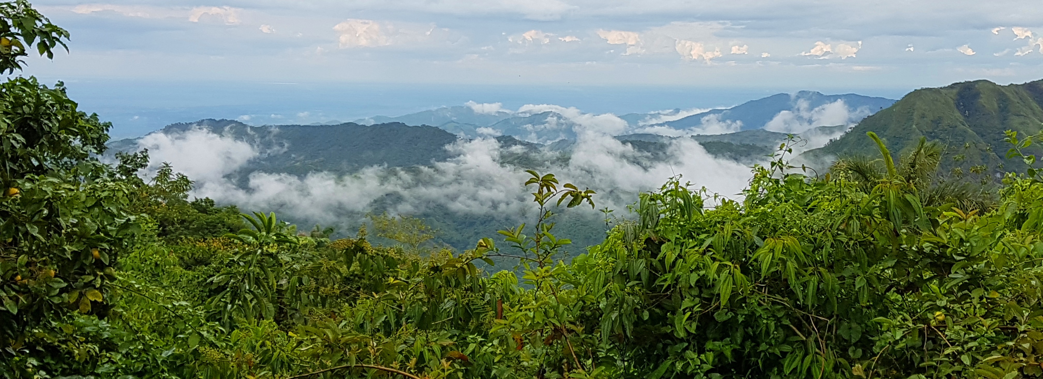
Our trek took a different direction from the trailhead with a new goal of the summit of Pico Turquino, the highest mountain in Cuba. No rain today but hot and shaded among the trees of the lush rain forest. A good news, bad news scenario. Shade helped us to climb but it also meant there were very few views of the mountains. Very lush and beautiful with the occasional flower and bird. Roots everywhere mixed with mud often made them undetectable. The route would get very steep for a couple of hours and no chance to stop without holding up those behind. Every couple of hours there would be a brief break to hydrate but no food provided. We could definitely use the calorie burn as long as it didn’t zap our energy for tomorrow. We continued on the steep natural staircases of uneven steps created over time by trekkers and settling mud. I wouldn’t normally use trekking poles going up but they sure save me on the descent. On this trek they were helpful for both directions.
 After 6 hours of ascent, which should usually take 5 hours, we arrived at Aguada del Joaquin or ‘The Huts’ at 1364 meters (4500 feet) . We’d been forewarned about the bad condition of the huts and were expecting to sleep on the ground anyway so we arrived to a pleasant surprise. We would each get a mattress and there were even toilets without seats that we could flush with a pail of water. This is actually high end living on a mountain but I would still prefer a tent. Lunch wasn’t served until 4pm and we were all pretty starving and thirsty at that point given ‘breakfast’ of one egg and stale bread was served at 5:30am. We were given one small bottle of water and told we would get one more before we headed out tomorrow. Yikes! Jeff and I drank 6 litres during today’s climb, how would we go twice as long tomorrow with such a small bottle of water? Then the food, I had to force feed myself, it was not pleasant. Plain pasta and rice with a squirt of Lea & Perrins?! A few stashed pieces of melted chocolate in my bag would have to suffice.

The group had a chat about the mileage markers on the way up. We were told it was 6 kilometers yesterday and today would be a steeper 8 kilometers, it was definitely much further. Sure enough that was confirmed by some wearing GPS trackers who said it was pretty much double the mileage. Apparently the markers used were announcing distance ‘as the crow flies’, not as a mountain trek winds with switchbacks. Ladies into one hut, gents into another and snorers were put in the worker hut. Jeff signed up for the worker hut and we all went down for long naps before rejigging our gear, ‘dinner’ and early lights out. No mountain bar hopping tonight.
Anatelli
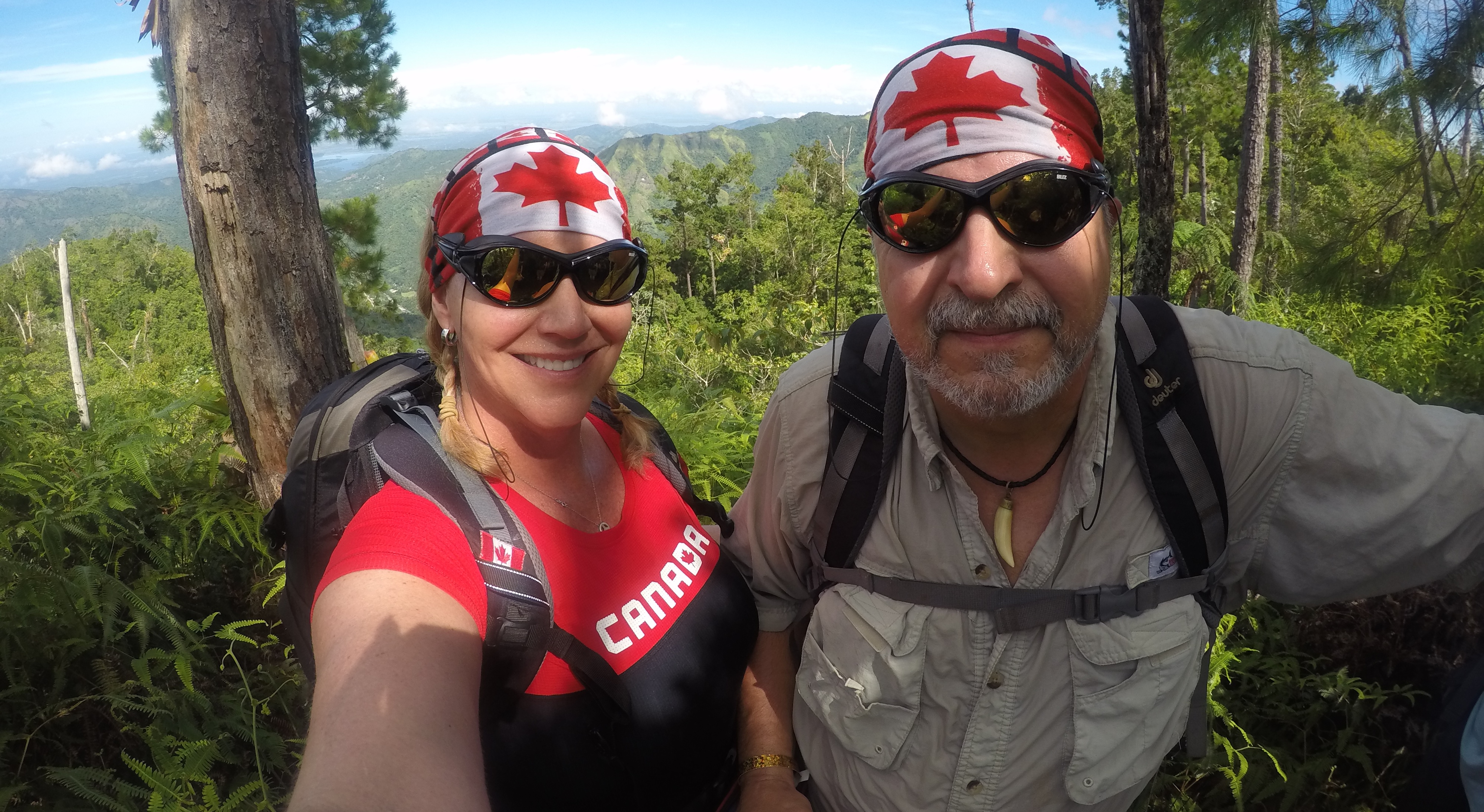
Tomorrow the UK team would climb to the summit and descend back to the same huts. My Adventure Buddy and I would meet a new guide at the summit who would get us down the other side of mountain range to the ocean at Las Cuevas. We would be the only ones climbing with all our gear instead of leaving behind our packs for pickup later. We were each carrying approximately 25 pounds. Fortunately, I don’t even notice my pack anymore and losing the weight of the water from the previous day made for a much lighter load, although I would much rather have water to carry!
Early wake up, ‘breakfast’ and we were off climbing again by 6am. We were warned the first two hours would be very steep and very challenging. That’s why we’re called ‘Mountain Climbers’! With a summit not yet in site at least we knew  every step was progress, or so we thought. We reached the top of a mountain and had a 180 degree view on an absolutely beautiful day. That was easier than we thought but aren’t we early and, where the heck is the statue? Turns out we were now on Pico Regino at 1686 meters. We start to descend and hope we find a ridge that bridges to the next mountain. Nope. We descend all the way to the bottom on the other side of the mountain we just climbed. All the way down! It was deflating.
One foot in front of the other, let’s do this. We start an ascent again and it goes on for a long time. This must be to the summit. Every opening in the trees I look back to see the mountain we just crested and eventually it looks like we are above it. Thank You! Nope. There is a sign and we are now 10 meters below where we were when we topped the last mountain. Pico Jacquin at 1676 meters. Really?! Okay, that’s 2 mountains so far this morning. Surely the next one is Pico Turquino.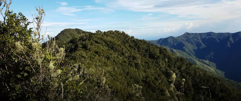
 Thoughts that have been stirring in his head are now starting to be verbalized by my Adventure Buddy. “This is no holiday!”, “Why do we do this?”, “I’m taking up cycling”, “Gotta tell you I’m done my bucket list with this sport. This is it for me!” Another mud field has us using too much energy to stay upright and I hear “WT*@*?!”. As the instigator of this pain fest, I take on the glass is half full role with words of encouragement and outlandish positive probabilities that would baffle the best odds makers. Fortunately we have opposing strengths, I’m strong on the ascent, he’s strong on the descent. You are what you think? I take up the rear so he can set the pace.
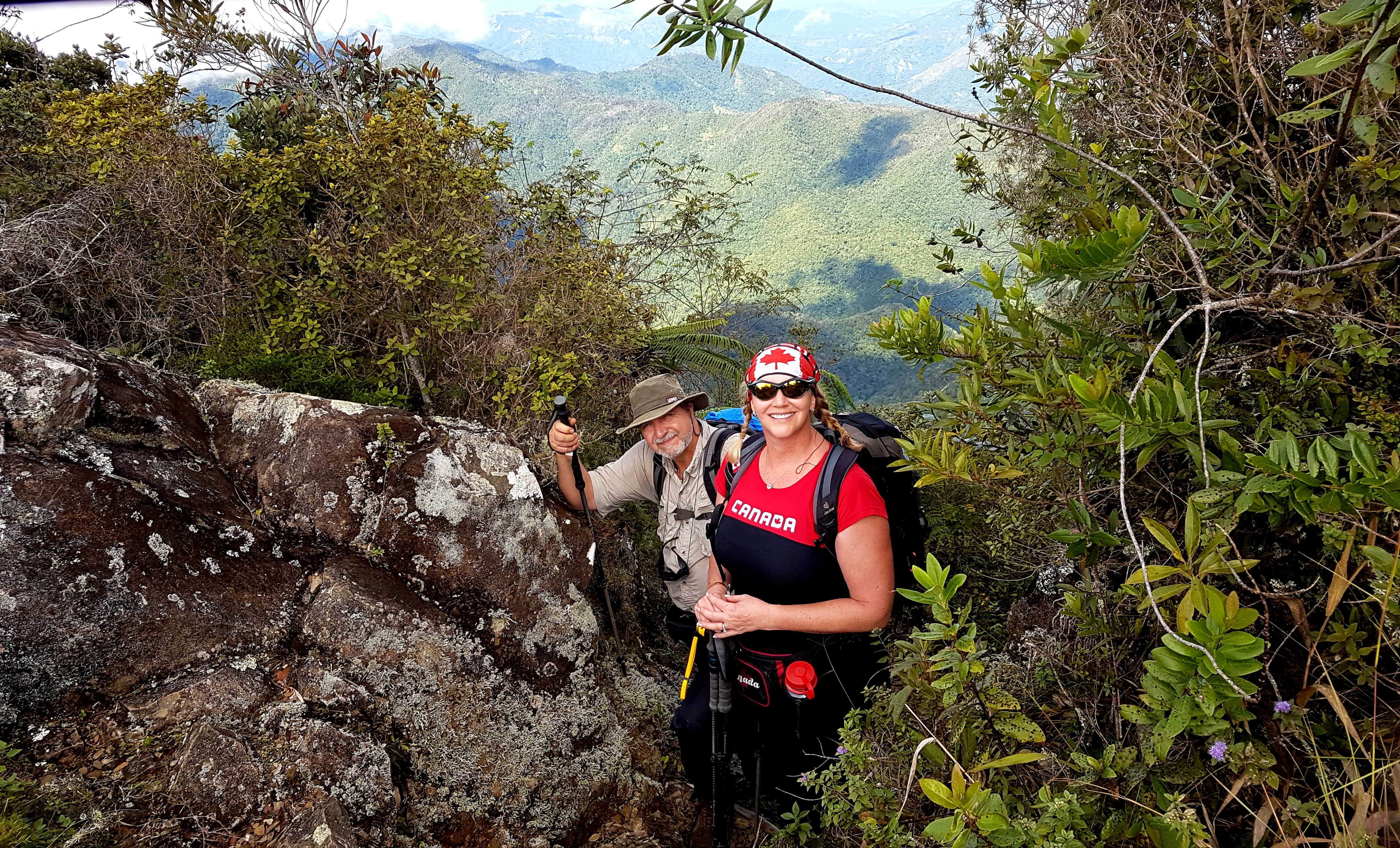
 Another mountain is summited! No one is excited, why is that? In fact, the keeners at the front are starting to enjoy longer breaks for pictures and venting huddles. That was the third mountain top. We go all the way down, down, down the other side of the mountain again. All the way, so far to the bottom that the looming mountains overhead are becoming overwhelmingly large and we can no longer identify trees, it just looks like green moss in the distance. We all know this is the day we are climbing THE highest mountain in Cuba so anything we can see we must get to the top of today. We haven’t even had a good view of Pico Turquino yet so we continue to trudge grudgingly out of the muddiest to the mushy then, the firm and finally realize this is the first time in two days we are not hearing squishy noises every single time we step. We must be at the highest point so far today. We have to be. If only we had a view of Pico Turquino.
Counting steps through the mystical features of the forest shrouded in vines just never ends. I keep looking up to see the top of the trees and there are always more trees in the background. One. Foot. In. Front. Of. The. Other. We don’t hear voices, it is just us waiting to hear cheers and chatter but the forest cloaks them with it’s natural sound barrier. We seem to be on flatter ground and the path oddly S’s for a while and then, all of a sudden, there is a clearing and we see a statue and the group. We are not excited. We are in the hot sun, we are tired and very thirsty, that’s all we can think about but we don’t dare sit down.

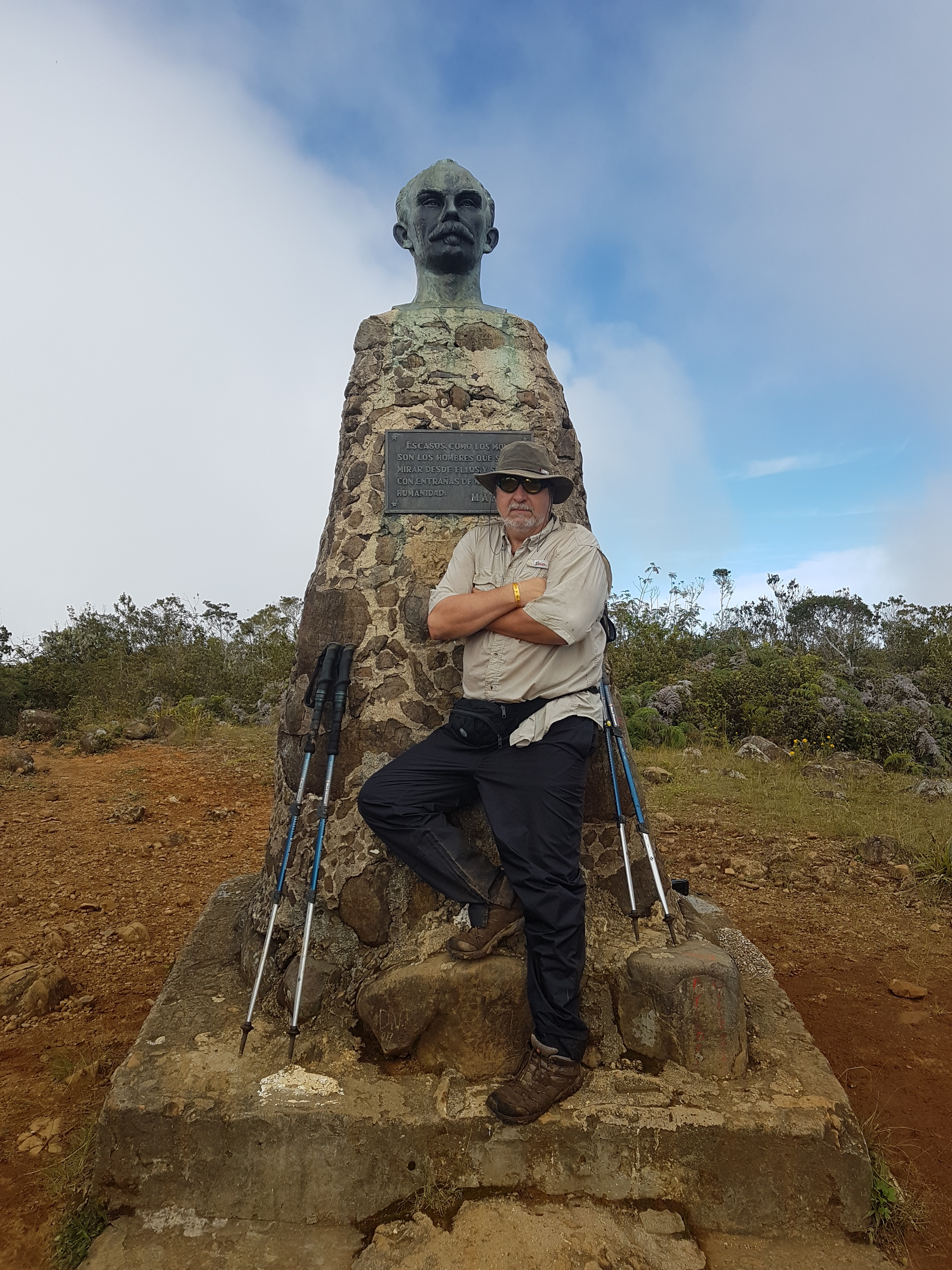
The lovely UK’ers high 5 us and laugh as I pull out my full size Canada flag. “We would never wear a Union Jack on our heads and we have never brought our flag”. Well, they don’t live in Canada! I don’t even need to verbalize this, it shows. Jeff and I share our last precious drops of rationed water and then a UK angel notices our distress and insists we take his bottle. We refuse but he reminds us they only have to go back to the huts; we have to descend all the way to the ocean. We acknowledge his kindness, say our good byes to our adopted team and they leave us to perform my ritual summit pictures all alone on the top of Pico Turquino at 1974 meters. I’m not even going to compare how low that is compared to all our other climbs, we’ve just crossed the tops and bottoms of a mountain range! The total ascent so far is approximately 4500 metres (15,000 feet). There is no view on the summit. You stare at a statue of national hero, Jose Marti, and wonder who the heck brought that all the way up here?

We meet our new guide who seemed so shy he couldn’t even look us in the eyes and there were no attempts to speak English. We remind ourselves of those Spanish lessons we keep meaning to pursue. Thank God we don’t have to go down what we just came up. Ignorance is bliss for a few very short minutes until that awful uneven natural staircase hits us in reverse and we realize this is the less traveled route to the summit. We are screwed, at least we are on the home stretch. The last decision I made before leaving our room at the resort was to leave my titanium knee brace behind. The one that’s kept me injury free for 2 years.
 Then we go up again, and up, and up. It is another mountain. The only words our guide speaks on the way down is when he points to the top of a mountain and says, “Pico Cuba”. It’s tall and we had to go all the way up to the top. That makes 5 mountains. We’re going to have temper tantrums if another mountain comes our way. I don’t want to stop at all, I know my energy, hydration and positive attitude is leaving me fast and we have no choice but to get down and hope our driver is where he’s suppose to be. We don’t know where that is but we sure hope he does. We play off each other with our reverse strengths. Jeff isn’t enjoying the descent either but I’m falling further behind, my knee is starting to hurt and I’m losing my footing. We come into another camp where trekkers would sleep overnight coming up this less traveled side. There is no food but they are able to sell us a can of soda, we rejoice. That nectar of the Gods will save the day and get us off this mountain.

The renewed energy is short lived as we continue our descent. I fall at one point breaking my trekking pole as it saves me from landing on a sharp rock. If that’s not a sign to cut calories I don’t know what is Lol Jeff starts to get worried about me and this seems to motivate him. We don’t need to talk, we’re a good team and now a veteran trekking team. He starts to speed ahead in long steps. I’m impressed but unmotivated to catch up. He eventually stops and waits until I finally catch up before announcing, “100 meters, 900 to go”, then continues his march. He has just come up with an imaginary distance for me, the Marathoner, to fixate on. Where’s my Garmin when I need it? I don’t need one, I have ‘Super Adventure Buddy’. He gets me down another couple of kilometers of steep descent with this game. Eventually there is a clearing with an actual picnic table and another statue. Must be a camp, this would be a nice campsite for the night but our chauffeur awaits. We hope.

We attempted sign language with our guide several times in our quest to find out how much further, it ended with a point, tilted arm up (aghast!), curve, down, corner and point straight ahead again. I actually memorize his gestures and replay them as I resume my hike and Jeff continues with his mileage marking. When I get to the corner before the point I look up expecting to see a long road and I see Jeff on a rock hanging on his poles with his head down just 300 meters ahead of me. I sit in the dirt right where I am and ponder how I will deal with my descent demons so I can help him now. Through the trees I see a small gap of ocean blue. FINALLY. I was more excited to see that ocean than I was the summit; another first. I point and yell, he gets up and continues his march to nowhere. He’s tired and hanging on his poles every few steps. I’m going to need to take the lead somehow. I see him march to a curve then stop and talk to the trees. He yells, “He’s here!”. We. Are. Done. Las Cuevas.

 It took us 6 hours to get down. It should have taken 5. That makes 10 hours in one day with next to no food or water. Unbeknownst to us there is a hut in Las Cuevas to feed you before you leave the park. That just doesn’t make any sense at all to us. We grab the soda they offered and hop into the car. Our driver was instructed by his boss to arrive an hour earlier then any faster climber might so he’s been waiting 2 1/2 hours for us to finish. We enjoy the magnificent coastal gravel drive with the mountain range on one side, immediate slope to the ocean on the other side, random boulders on the road from the mountains and every animal you can imagine freely roaming; bulls, horses, goats, cows, ducks, roosters, dogs. It was like nirvana and replaced the normal joy I would have at a summit. This climb my summit was getting down.

Five minutes into the ride back to our resort, Mr. “I’m Done My Mountain Bucket List’ says, “Well, maybe I’ll go to Nepal with you.” Laughter
20 hours of climbing over 3 days. 50 kilometers (non-Crow) up and down 5+ mountain summits, through a rain forest and across a mountain range. What a Ride!


Pingback: 5 Years of Challenges – karengeterdone
Rosalie Resnick
Love your blogs, so well written. I feel like I have traveled Cuba.
You are both so inspiring!
Love
LikeLiked by 1 person
karengeterdone
Love getting your feedback Rosalie! Thanks
LikeLike
Ed Consenheim
Great JOB, well written and done, Love Ed
LikeLiked by 1 person
karengeterdone
Thanks Ed, really appreciate your feedback.
LikeLike
Hermie
You are amazing Karen , certainly a terrific motivator, proud of Jeff too ! Love Hermie !
LikeLiked by 1 person
karengeterdone
Thanks so much Hermie. I am SO glad you created my Adventure Buddy 🙂
LikeLike